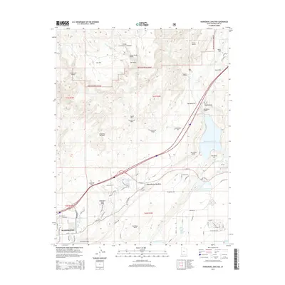
2014 Map of Harrisburg Junction
USGS Topo · Published 2014About this map
Harrisburg and the developing residential corridors of Washington define the landscape of this Washington County survey. The terrain is characterized by dramatic geologic features, including the prominent White Reef and Leeds Reef to the northeast, and the expansive Washington Black Ridge overlooking the southern valleys. Significant water infrastructure is central to the area's modern footprint, with the large Quail Creek Reservoir situated near Harrisburg Bench and the Sand Hollow Reservoir at the southeastern corner. Historical springs such as Berry Spring and Willow Spring suggest the foundational water sources that once supported early settlement. To the north, the protected lands of the Dixie National Forest contrast with the growing network of roads like Telegraph St and W State St, illustrating the expansion of the St. George metropolitan area into the surrounding desert flats and canyons.
Find a feature on this map
64 named features on this map. Tap any name to fly to it.
Don’t see what you’re looking for? This feature index may not catch every label — zoom into the map to look around manually.
Map Details
Editions of this 2014 Harrisburg Junction Map
This is the sole edition of this map. No revisions or reprints were ever made.
Other maps of this area

1885 · St. George
USGS Topo · 1:250,000

1891 · St. George
USGS Topo · 1:250,000

1953 · Cedar City
USGS Topo · 1:250,000

1954 · La Verkin 3 NW
USGS Topo · 1:24,000

1954 · La Verkin 3 NE
USGS Topo · 1:24,000

1954 · La Verkin 3 SE
USGS Topo · 1:24,000

1954 · La Verkin 3 SW
USGS Topo · 1:24,000

1954 · La Verkin 2 SE
USGS Topo · 1:24,000

1954 · St. George
USGS Topo · 1:62,500

1954 · Hurricane
USGS Topo · 1:62,500