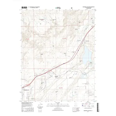
2017 Map of Harrisburg Junction
USGS Topo · Published 2017About this map
Dixie National Forest covers the northwestern corner of this territory, where the terrain breaks into complex formations like Yant Flat and the sandstone ridges of Yankee Doodle Hollow. The central corridor is dominated by a transition from high desert plateaus down toward the Virgin River valley. This 2017 survey documents the modern layout of Harrisburg Junction and the encroaching northern residential streets of Washington as they meet the geologic barrier of the Black Ridge.
Find a feature on this map
104 named features on this map. Tap any name to fly to it.
Don’t see what you’re looking for? This feature index may not catch every label — zoom into the map to look around manually.
Map Details
Editions of this 2017 Harrisburg Junction Map
This is the sole edition of this map. No revisions or reprints were ever made.
Other maps of this area

1885 · St. George
USGS Topo · 1:250,000

1891 · St. George
USGS Topo · 1:250,000

1953 · Cedar City
USGS Topo · 1:250,000

1954 · La Verkin 3 NW
USGS Topo · 1:24,000

1954 · La Verkin 3 NE
USGS Topo · 1:24,000

1954 · La Verkin 3 SE
USGS Topo · 1:24,000

1954 · La Verkin 3 SW
USGS Topo · 1:24,000

1954 · La Verkin 2 SE
USGS Topo · 1:24,000

1954 · St. George
USGS Topo · 1:62,500

1954 · Hurricane
USGS Topo · 1:62,500