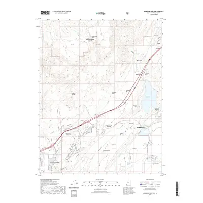
2020 Map of Harrisburg Junction
USGS Topo · Published 2020About this map
Dixie National Forest dominates the northern landscape of this region, where the high desert meets the stark geology of the White Reef and Leeds Reef. The topography is defined by significant drainage systems and geological formations, including Yant Flat and the massive Harrisburg Dome south of the freeway. The modern infrastructure of Washington and Hurricane surrounds the central Quail Creek Reservoir, a vital water resource in this arid environment.
Find a feature on this map
103 named features on this map. Tap any name to fly to it.
Don’t see what you’re looking for? This feature index may not catch every label — zoom into the map to look around manually.
Map Details
Editions of this 2020 Harrisburg Junction Map
This is the sole edition of this map. No revisions or reprints were ever made.
Other maps of this area

1885 · St. George
USGS Topo · 1:250,000

1891 · St. George
USGS Topo · 1:250,000

1953 · Cedar City
USGS Topo · 1:250,000

1954 · La Verkin 3 NW
USGS Topo · 1:24,000

1954 · La Verkin 3 NE
USGS Topo · 1:24,000

1954 · La Verkin 3 SE
USGS Topo · 1:24,000

1954 · La Verkin 3 SW
USGS Topo · 1:24,000

1954 · La Verkin 2 SE
USGS Topo · 1:24,000

1954 · St. George
USGS Topo · 1:62,500

1954 · Hurricane
USGS Topo · 1:62,500