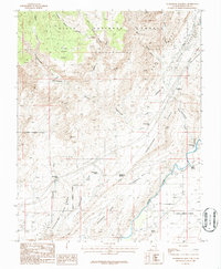
1986 Map of Harrisburg Junction
USGS Topo · Published 1987About this map
The Virgin River flows through the southeastern corner of this terrain, where the historic Harrisburg (Site) and the contemporary Harrisburg Junction mark the intersection of desert settlement and transportation. The landscape is defined by massive geologic features, including the Red Reef and White Reef to the east and the high plateau of Yant Flat near the Dixie National Forest boundary in the north. This mid-1980s provisional study records a transition between natural landmarks and growing human footprints, visible in the Washington Corporate Boundary and the proximity of the Hurricane Corporate Boundary. Researchers can trace old water sources such as Berry Springs and Willow Spring, while the intricate drainage of Cottonwood Creek and Quail Creek highlights the erosive force that carved the Harrisburg Gap.
Find a feature on this map
35 named features on this map. Tap any name to fly to it.
Don’t see what you’re looking for? This feature index may not catch every label — zoom into the map to look around manually.
Map Details
Editions of this 1986 Harrisburg Junction Map
This is the sole edition of this map. No revisions or reprints were ever made.
Other maps of this area

1885 · St. George
USGS Topo · 1:250,000

1891 · St. George
USGS Topo · 1:250,000

1953 · Cedar City
USGS Topo · 1:250,000

1954 · La Verkin 3 NW
USGS Topo · 1:24,000

1954 · La Verkin 3 NE
USGS Topo · 1:24,000

1954 · La Verkin 3 SE
USGS Topo · 1:24,000

1954 · La Verkin 3 SW
USGS Topo · 1:24,000

1954 · La Verkin 2 SE
USGS Topo · 1:24,000

1954 · St. George
USGS Topo · 1:62,500

1954 · Hurricane
USGS Topo · 1:62,500