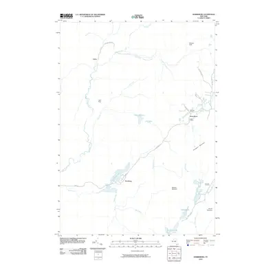
2010 Map of Harrisburg
USGS Topo · Published 2010About this map
Harrisburg sits at the heart of this Warren County landscape, positioned where Harrisburg Lake meets the surrounding creek systems. This region is defined by its numerous water bodies and rugged peaks, including Bearpen Peak in the north and Spruce Mountain to the southeast. The settlement patterns reflect a quiet Adirondack character, with small clusters like Fullers and Knowelhurst linked by winding corridors such as W Stony Creek Rd and Harrisburg Rd. Genealogists will find significant local value in the scattered burial grounds that dot the area, including the Van Dusen Cemetery near Fly Creek and the Lens Lake Cemetery further south. The hydrography is particularly complex, featuring names like Middle Flow and Saint John Lake, illustrating a terrain where seasonal water movement and stationary lakes dictate the placement of local infrastructure and private property lines.
Find a feature on this map
35 named features on this map. Tap any name to fly to it.
Don’t see what you’re looking for? This feature index may not catch every label — zoom into the map to look around manually.
Map Details
Editions of this 2010 Harrisburg Map
This is the sole edition of this map. No revisions or reprints were ever made.
Other maps of this area

1895 · North Creek
USGS Topo · 1:62,500

1897 · North Creek
USGS Topo · 1:62,500

1898 · Thirteenth Lake
USGS Topo · 1:62,500

1903 · Luzerne
USGS Topo · 1:62,500

1910 · Stony Creek
USGS Topo · 1:62,500

1950 · Glens Falls
USGS Topo · 1:250,000

1950 · Utica
USGS Topo · 1:250,000

1954 · Thirteenth Lake
USGS Topo · 1:62,500

1954 · Harrisburg
USGS Topo · 1:62,500
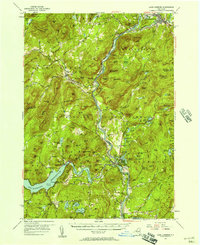
1955 · Lake Luzerne
USGS Topo · 1:62,500