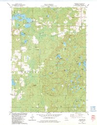
1982 Map of Harrison
USGS Topo · Published 1983About this map
Glacial topography and early 20th-century logging remnants define this Lincoln County landscape, centered on the settlement of Harrison. The terrain is dominated by a dense network of kettle lakes and wetlands, including Alice Lake, Bughouse Lake, and Crane Foot Lake. The presence of the Green Grade and an Old RR Gr underscores the region's industrial heritage, tracing the paths of former logging railroads that once moved timber through these woods.
Find a feature on this map
53 named features on this map. Tap any name to fly to it.
Don’t see what you’re looking for? This feature index may not catch every label — zoom into the map to look around manually.
Map Details
Editions of this 1982 Harrison Map
This is the sole edition of this map. No revisions or reprints were ever made.
Other maps of this area

1939 · Cassian
USGS Topo · 1:48,000

1940 · Parrish
USGS Topo · 1:48,000

1940 · Rhinelander
USGS Topo · 1:48,000

1942 · Cassian
USGS Topo · 1:48,000

1949 · Rhinelander
USGS Topo · 1:48,000

1950 · Parrish
USGS Topo · 1:48,000

1950 · Tomahawk
USGS Topo · 1:48,000

1952 · Parrish
USGS Topo · 1:48,000

1952 · Tomahawk
USGS Topo · 1:48,000

1954 · Iron Mountain
USGS Topo · 1:250,000