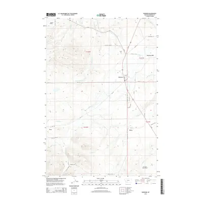
2014 Map of Harrison
USGS Topo · Published 2014About this map
Harrison serves as the primary hub in this Madison County landscape, where the intersection of Us-287 and MT-359 defines the local transit corridor. The map reveals a sophisticated water management system designed for high-altitude agriculture and historical mining, evidenced by the Roebert and Warren Ditch and the Norwegian Placer Gulch to the south. Local heritage is centered around the Harrison Cem and the Harrison Mill, while the small settlement of Pony sits at the edge of the more significant elevation gains. The drainage patterns of N Willow Cr and S Willow Cr dictate the layout of rural roads and homesteads, connecting Summit Valley to the lower reaches of the basin near Shaws. Historical transportation roots are visible in the path of the Yellowstone Trl, reflecting the early twentieth-century push for transcontinental motor routes through Montana.
Find a feature on this map
41 named features on this map. Tap any name to fly to it.
Don’t see what you’re looking for? This feature index may not catch every label — zoom into the map to look around manually.
Map Details
Editions of this 2014 Harrison Map
This is the sole edition of this map. No revisions or reprints were ever made.
Other maps of this area

1888 · Three Forks
USGS Topo · 1:250,000

1894 · Three Forks
USGS Topo · 1:250,000

1895 · Three Forks
USGS Topo · 1:250,000

1947 · Bozeman
USGS Topo · 1:250,000

1948 · Bozeman
USGS Topo · 1:250,000

1949 · Norris
USGS Topo · 1:62,500

1950 · Three Forks
USGS Topo · 1:62,500

1950 · Jefferson Island
USGS Topo · 1:62,500

1950 · Harrison
USGS Topo · 1:62,500

1951 · Norris
USGS Topo · 1:62,500