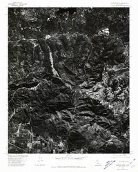
1975 Map of Harrison Mtn.
USGS Topo · Published 1981About this map
The northern reaches of San Bernardino meet the rising slopes of the San Bernardino Mountains in this mid-1970s orthophotoquad. Produced by the U.S. Geological Survey in cooperation with the Soil Conservation Service, this map utilizes aerial imagery from September 1975 to document the distinct boundary between urban development and the steep, undeveloped terrain of the Harrison Mtn. region. While the lower southwestern corner shows a structured grid of residential streets and industrial plots, the remainder of the landscape is dominated by complex drainages and fire breaks that traverse the ridges. This photographic record captures a specific moment in the growth of Southern California, showing where the expansion of the city begins to negotiate with the natural geography of the Transverse Ranges.
Find a feature on this map
1 named feature on this map. Tap any name to fly to it.
Don’t see what you’re looking for? This feature index may not catch every label — zoom into the map to look around manually.
Map Details
Editions of this 1975 Harrison Mtn. Map
This is the sole edition of this map. No revisions or reprints were ever made.
Other maps of this area

1896 · San Bernardino
USGS Topo · 1:62,500

1898 · San Bernardino
USGS Topo · 1:62,500

1899 · Redlands
USGS Topo · 1:62,500

1901 · Southern California Sheet No. 1
USGS Topo · 1:250,000

1901 · San Bernardino
USGS Topo · 1:62,500

1901 · Redlands
USGS Topo · 1:62,500

1902 · Deep Creek
USGS Topo · 1:62,500

1902 · Hesperia
USGS Topo · 1:62,500

1904 · Southern California Sheet No. 1
USGS Topo · 1:250,000

1936 · Arrowhead
USGS Topo · 1:31,680