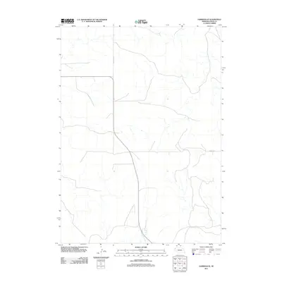
2011 Map of Harrison SE
USGS Topo · Published 2011About this map
The sparsely settled expanse of Whistle Creek Precinct in Sioux County defines this corner of Nebraska. The landscape is characterized by its agricultural isolation, where long-distance travel is facilitated by a few key corridors. Most notable is the path of Evergreen Rd, which cuts north-south through the terrain, and Buckley Rd, which connects the eastern reaches of the quadrangle. These routes serve as the primary lifelines for the scattered farmsteads and ranching operations that have long dominated this high plains region, reflecting a rural infrastructure that has remained largely unchanged in its fundamental layout into the twenty-first century.
Find a feature on this map
2 named features on this map. Tap any name to fly to it.
Don’t see what you’re looking for? This feature index may not catch every label — zoom into the map to look around manually.
Map Details
Editions of this 2011 Harrison SE Map
This is the sole edition of this map. No revisions or reprints were ever made.
Other maps of this area

1899 · Whistle Creek
USGS Topo · 1:125,000

1955 · Alliance
USGS Topo · 1:250,000

1957 · Alliance
USGS Topo · 1:250,000

1958 · Alliance
USGS Topo · 1:250,000

1978 · Harrison West
USGS Topo · 1:24,000

1979 · Harrison SE
USGS Topo · 1:24,000
1979 · Harrison SW
USGS Topo · 1:24,000
1979 · Agate NW
USGS Topo · 1:24,000

1979 · Agate
USGS Topo · 1:24,000

1979 · Harrison East
USGS Topo · 1:24,000