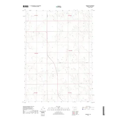
2017 Map of Harrison SE
USGS Topo · Published 2017About this map
The High Plains of Sioux County are defined by a complex network of drainage basins and ridges in this 2017 survey. The landscape is primarily organized by the Public Land Survey System, featuring large township sections such as t30n r56w and t29n r55w. This area is characterized by its rural infrastructure, where long-established routes like Evergreen Rd and Buckley Rd serve as the primary conduits through the undulating terrain. The drainage patterns on this sheet illustrate the headwaters of the regional creek systems, showing how the natural topography dictates the placement of these vital section-line roads.
Find a feature on this map
8 named features on this map. Tap any name to fly to it.
Don’t see what you’re looking for? This feature index may not catch every label — zoom into the map to look around manually.
Map Details
Editions of this 2017 Harrison SE Map
This is the sole edition of this map. No revisions or reprints were ever made.
Other maps of this area

1899 · Whistle Creek
USGS Topo · 1:125,000

1955 · Alliance
USGS Topo · 1:250,000

1957 · Alliance
USGS Topo · 1:250,000

1958 · Alliance
USGS Topo · 1:250,000

1978 · Harrison West
USGS Topo · 1:24,000

1979 · Harrison SE
USGS Topo · 1:24,000
1979 · Harrison SW
USGS Topo · 1:24,000
1979 · Agate NW
USGS Topo · 1:24,000

1979 · Agate
USGS Topo · 1:24,000

1979 · Harrison East
USGS Topo · 1:24,000