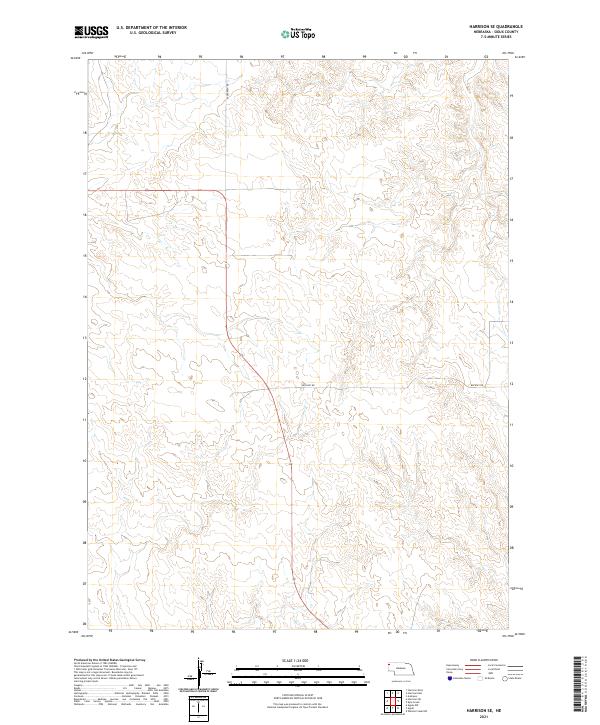
2021 Map of Harrison SE
USGS Topo · Published 2021About this map
Sioux County high plains terrain is defined by a sparse network of county roads and a strict rectangular grid of the Public Land Survey System. In this 2021 topographic record, Evergreen Rd provides one of the few north-south corridors through the northern sections of the quadrangle, including townships t31n r56w and t31n r55w. Farther south, Buckley Rd cuts across the landscape, linking remote ranchlands and following the contours of the Nebraska Panhandle’s drainage patterns. This map illustrates the intersection of modern road infrastructure with historical township boundaries that have governed land ownership in this portion of Nebraska for over a century.
Find a feature on this map
8 named features on this map. Tap any name to fly to it.
Don’t see what you’re looking for? This feature index may not catch every label — zoom into the map to look around manually.
Map Details
Editions of this 2021 Harrison SE Map
This is the sole edition of this map. No revisions or reprints were ever made.
Other maps of this area

1899 · Whistle Creek
USGS Topo · 1:125,000

1955 · Alliance
USGS Topo · 1:250,000

1957 · Alliance
USGS Topo · 1:250,000

1958 · Alliance
USGS Topo · 1:250,000

1978 · Harrison West
USGS Topo · 1:24,000

1979 · Harrison SE
USGS Topo · 1:24,000
1979 · Harrison SW
USGS Topo · 1:24,000
1979 · Agate NW
USGS Topo · 1:24,000

1979 · Agate
USGS Topo · 1:24,000

1979 · Harrison East
USGS Topo · 1:24,000