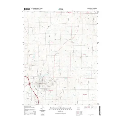
2015 Map of Harrisonville
USGS Topo · Published 2015About this map
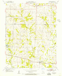
Harrisonville serves as the focal point of this 2015 study, illustrating the modern expansion and land use patterns in Cass County. The landscape is defined by its transition from the structured residential and commercial grid of the city center to the surrounding agricultural territories of Huber and Ore. Numerous water bodies, such as Harrisonville City Lake, North Lake, and Lake Luna, are interspersed among the drainages of Town Cr and Muddy Cr. Historical continuity is preserved through established sites like Orient Cemetery and Harris Cemetery, while the presence of Richters Airport and the Twin Pines Country Club Lake reflects contemporary local infrastructure. Prominent elevations like Kohler Hill and Brookhart Hill rise above the drainage basins of Eightmile Cr and Crooked Br, providing a clear view of the area's relief and the enduring Mo-P rail corridor that influenced the region's initial development.
Find a feature on this map
121 named features on this map. Tap any name to fly to it.
Don’t see what you’re looking for? This feature index may not catch every label — zoom into the map to look around manually.
Map Details
Editions of this 2015 Harrisonville Map
This is the sole edition of this map. No revisions or reprints were ever made.
Other maps of this area

1887 · Harrisonville
USGS Topo · 1:125,000

1892 · Harrisonville
USGS Topo · 1:125,000

1894 · Harrisonville
USGS Topo · 1:125,000

1947 · Lawrence
USGS Topo · 1:250,000

1950 · Lawrence
USGS Topo · 1:250,000
1953 · Everett
USGS Topo · 1:24,000

1954 · Harrisonville
USGS Topo · 1:24,000
1954 · East Lynne
USGS Topo · 1:24,000
1954 · Raymore
USGS Topo · 1:24,000
1954 · Strasburg
USGS Topo · 1:24,000