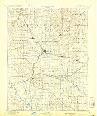
1892 Map of Harrisonville
USGS Topo · Published 1932About this map
Harrisonville serves as the central hub for a complex web of late-19th-century transport, where the Missouri Pacific Railroad and the Kansas City and Southern Railroad intersect. This 1892 survey of Cass and Johnson counties illustrates a landscape transitioning from rural prairie to an established rail-dependent economy. Notable settlements like Pleasant Hill and Lees Summit appear along primary lines, while smaller outposts such as Daugherty (Eight Mile P.O.) and Index mark the early postal and commerce network of the Missouri backcountry. The drainage patterns of the Grand River and Big Creek define the agricultural limits of the era, with prominent landmarks like Hutton Mound rising above the surrounding plains. For researchers, the map clearly delineates township boundaries including Van Buren, Peculiar, and Camp Branch, offering a detailed look at the geographic organization of the region before 20th-century development.
Find a feature on this map
88 named features on this map. Tap any name to fly to it.
Don’t see what you’re looking for? This feature index may not catch every label — zoom into the map to look around manually.
Map Details
Editions of this 1892 Harrisonville Map
2 editions found
Other maps of this area

1885 · Warrensburg
USGS Topo · 1:125,000

1887 · Clinton
USGS Topo · 1:125,000

1887 · Harrisonville
USGS Topo · 1:125,000

1887 · Olathe
USGS Topo · 1:125,000

1887 · Butler
USGS Topo · 1:125,000

1887 · Mound City
USGS Topo · 1:125,000

1887 · Warrensburg
USGS Topo · 1:125,000

1889 · Lexington
USGS Topo · 1:125,000

1890 · Kansas City
USGS Topo · 1:125,000

1892 · Harrisonville
USGS Topo · 1:125,000