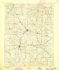
1894 Map of Harrisonville
USGS Topo · Published 1894About this map
Harrisonville serves as a central hub in this late nineteenth-century survey, anchoring a landscape increasingly defined by a complex web of iron rails. The expansion of the Missouri Pacific Railroad and the Kansas City Clinton and Lexington Railroad illustrates the shift from isolated prairie townships to connected trade centers. Small agrarian settlements such as Peculiar and Gunn City appear alongside important stage and post stops like Daugherty (Eight Mile P. O.).
Find a feature on this map
82 named features on this map. Tap any name to fly to it.
Don’t see what you’re looking for? This feature index may not catch every label — zoom into the map to look around manually.
Map Details
Editions of this 1894 Harrisonville Map
This is the sole edition of this map. No revisions or reprints were ever made.
Other maps of this area
1885 · Warrensburg
USGS Topo · 1:125,000
1887 · Clinton
USGS Topo · 1:125,000

1887 · Harrisonville
USGS Topo · 1:125,000

1887 · Olathe
USGS Topo · 1:125,000
1887 · Butler
USGS Topo · 1:125,000
1887 · Mound City
USGS Topo · 1:125,000
1887 · Warrensburg
USGS Topo · 1:125,000
1889 · Lexington
USGS Topo · 1:125,000

1890 · Kansas City
USGS Topo · 1:125,000
1892 · Harrisonville
USGS Topo · 1:125,000