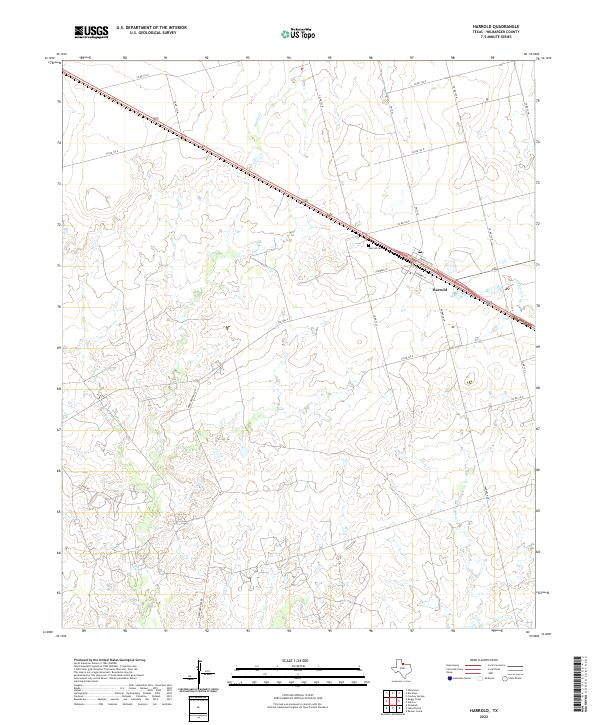
2022 Map of Harrold
USGS Topo · Published 2022About this map
Harrold serves as the central hub of this North Texas landscape, where the local post office and historic Harrold Cem stand as markers of a long-established rural community. The settlement is defined by a dense network of county roads, such as Co RD 138 E and Co RD 140 E, which provide access to the surrounding agricultural land. This topography is carved by a series of north-flowing tributaries including Adams Cr, China Cr, and Rock Cr, which drain into the Red River basin. The presence of Hereford Pens Rd suggests the enduring importance of the cattle industry to the local economy. Together, these features document the modern layout of a Wilbarger County ranching and farming district, illustrating how infrastructure follows the natural drainages of the Texas plains.
Find a feature on this map
28 named features on this map. Tap any name to fly to it.
Don’t see what you’re looking for? This feature index may not catch every label — zoom into the map to look around manually.
Map Details
Editions of this 2022 Harrold Map
This is the sole edition of this map. No revisions or reprints were ever made.
Other maps of this area

1916 · Electra
USGS Topo · 1:24,000

1917 · Beaver Creek
USGS Topo · 1:24,000

1918 · Electra
USGS Topo · 1:31,680

1920 · Beaver Creek
USGS Topo · 1:31,680

1954 · Wichita Falls
USGS Topo · 1:250,000

1955 · Lawton
USGS Topo · 1:250,000

1958 · Wichita Falls
USGS Topo · 1:250,000

1958 · Davidson
USGS Topo · 1:62,500

1958 · Electra
USGS Topo · 1:62,500

1966 · Grayback
USGS Topo · 1:24,000