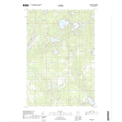
2018 Map of Harshaw
USGS Topo · Published 2018About this map
Goodnow and Harshaw anchor this Northwoods landscape, a region defined by an intricate network of glacial lakes and wetlands in Oneida County. The map details the hydrology of the upper Wisconsin basin, where the Tomahawk River and Rocky Run wind through timberlands. A high density of named water bodies, including the large Bearskin Lake and the cluster of Muskie Lake, Little Muskie Lake, and Sand Lake, illustrates the area's development around recreational and natural resources. Local history is centered at Union Grove Cem and the small aviation facility at Pinewood Air Park. Throughout the quadrangle, residential and resort development is evident along corridors like Bearskin Creek and the shores of Oneida Lake, reflecting the transition from early settlement to a modern lakeland community.
Find a feature on this map
83 named features on this map. Tap any name to fly to it.
Don’t see what you’re looking for? This feature index may not catch every label — zoom into the map to look around manually.
Map Details
Editions of this 2018 Harshaw Map
This is the sole edition of this map. No revisions or reprints were ever made.
Other maps of this area

1938 · Minocqua
USGS Topo · 1:48,000

1938 · Lac Du Flambeau
USGS Topo · 1:48,000

1939 · Lac Du Flambeau
USGS Topo · 1:48,000

1939 · Mc Cord
USGS Topo · 1:48,000

1939 · Cassian
USGS Topo · 1:48,000

1942 · Cassian
USGS Topo · 1:48,000

1946 · Minocqua
USGS Topo · 1:48,000

1946 · Lac Du Flambeau
USGS Topo · 1:48,000

1947 · Mc Cord
USGS Topo · 1:48,000

1949 · Minocqua
USGS Topo · 1:48,000