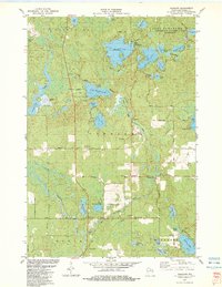
1982 Map of Harshaw
USGS Topo · Published 1983About this map
Glacial lakes and meandering waterways dominate this landscape within the Northern Highland-American Legion State Forest, where the settlement of Harshaw serves as a local hub. The map illustrates a complex hydrographic network, including the Tomahawk River and significant bodies of water like Bearskin Lake and Oneida Lake. The conversion of the Milwaukee Road corridor into the Bearskin State Park Trail highlights a period of transition from active logging-era rail transport to recreational use.
Find a feature on this map
72 named features on this map. Tap any name to fly to it.
Don’t see what you’re looking for? This feature index may not catch every label — zoom into the map to look around manually.
Map Details
Editions of this 1982 Harshaw Map
This is the sole edition of this map. No revisions or reprints were ever made.
Other maps of this area

1938 · Minocqua
USGS Topo · 1:48,000

1938 · Lac Du Flambeau
USGS Topo · 1:48,000

1939 · Lac Du Flambeau
USGS Topo · 1:48,000

1939 · Mc Cord
USGS Topo · 1:48,000

1939 · Cassian
USGS Topo · 1:48,000

1942 · Cassian
USGS Topo · 1:48,000

1946 · Minocqua
USGS Topo · 1:48,000

1946 · Lac Du Flambeau
USGS Topo · 1:48,000

1947 · Mc Cord
USGS Topo · 1:48,000

1949 · Minocqua
USGS Topo · 1:48,000