
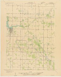
1931 Map of Hart NE
USGS Topo · Published 1931About this map
The Hart townsite serves as the primary hub of this northern Michigan landscape, situated at the head of Hart Lake where the Pentwater River begins its westward course. The 1931 survey reveals a dense network of rural infrastructure, characterized by an exceptional number of district schoolhouses that anchored the farming community. Family-named institutions such as Cargill Sch, Sackrider Sch, and Van Wickle Sch are distributed across the townships of Crystal and Weare, showing the early 20th-century reliance on local neighborhood centers.
Find a feature on this map
29 named features on this map. Tap any name to fly to it.
Don’t see what you’re looking for? This feature index may not catch every label — zoom into the map to look around manually.
Map Details
Editions of this 1931 Hart NE Map
2 editions found
Other maps of this area

1931 · Hart NW
USGS Topo · 1:31,680

1931 · Custer SW
USGS Topo · 1:31,680

1931 · Hart SE
USGS Topo · 1:31,680

1931 · Walkerville SW
USGS Topo · 1:31,680

1931 · Walkerville NW
USGS Topo · 1:31,680

1932 · Ludington SW
USGS Topo · 1:31,680

1932 · Ludington SE
USGS Topo · 1:31,680

1954 · Milwaukee
USGS Topo · 1:250,000

1958 · Milwaukee
USGS Topo · 1:250,000

1958 · Hesperia
USGS Topo · 1:62,500