
1959 Map of Hart
USGS Topo · Published 1961About this map
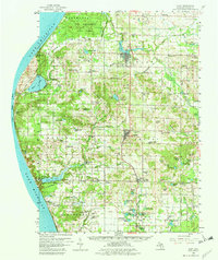
Lake Michigan dominates the western edge of this 1959 survey, where the moving dunes of Little Point Sable and the recreational waters of Silver Lake State Park meet the shoreline. Inland, the landscape transition from the Pere Marquette State Forest in the north to the Manistee National Forest in the southeast is punctuated by a dense network of agriculture and rural institutions. The Chesapeake and Ohio railroad corridor serves as the primary spine for development, linking the established hubs of Hart, Shelby, and New Era.
Find a feature on this map
138 named features on this map. Tap any name to fly to it.
Don’t see what you’re looking for? This feature index may not catch every label — zoom into the map to look around manually.
Map Details
Editions of this 1959 Hart Map
3 editions found
Other maps of this area

1929 · Montague
USGS Topo · 1:48,000

1931 · Hart NW
USGS Topo · 1:31,680

1931 · Custer SW
USGS Topo · 1:31,680

1931 · Hart SE
USGS Topo · 1:31,680

1931 · Hart NE
USGS Topo · 1:31,680

1931 · Walkerville SW
USGS Topo · 1:31,680

1931 · Walkerville NW
USGS Topo · 1:31,680

1932 · Ludington SW
USGS Topo · 1:31,680

1932 · Ludington SE
USGS Topo · 1:31,680

1954 · Milwaukee
USGS Topo · 1:250,000