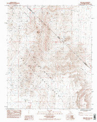
1984 Map of Hart Peak
USGS Topo · Published 1984About this map
Hart (Site) sits at the base of the Castle Mountains, a remnant of the early twentieth-century mining activity that once defined this portion of the East Mojave. This 1984 provisional survey illustrates the landscape of the Mojave National Scenic Area as it transitioned into a federally protected zone. The map documents the historic Von Schmidt Line (1873), an early attempt to survey the border between California and Nevada, which cuts diagonally across the high desert terrain. Local history and genealogy interest is found in the small Cem located near the old townsite and the numerous Prospects dotting the slopes surrounding Hart Peak. Arid land features such as Malpais Springs, Lewis Holes, and Quail Spring are carefully noted, indicating the vital water sources required for survival and industry in the Piute Valley and Lanfair Valley.
Find a feature on this map
15 named features on this map. Tap any name to fly to it.
Don’t see what you’re looking for? This feature index may not catch every label — zoom into the map to look around manually.
Map Details
Editions of this 1984 Hart Peak Map
2 editions found
Other maps of this area

1886 · Camp Mohave
USGS Topo · 1:250,000

1892 · Camp Mohave
USGS Topo · 1:250,000

1910 · Ivanpah
USGS Topo · 1:250,000

1912 · Ivanpah
USGS Topo · 1:250,000

1926 · Mohave City
USGS Topo · 1:96,000

1942 · Camp Mohave
USGS Topo · 1:250,000

1942 · Ivanpah
USGS Topo · 1:250,000

1947 · Kingman
USGS Topo · 1:250,000

1948 · Kingman
USGS Topo · 1:250,000

1954 · Kingman
USGS Topo · 1:250,000