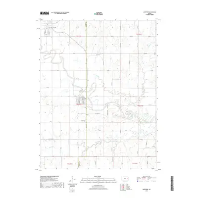
2018 Map of Hartford
USGS Topo · Published 2018About this map
Hartford and Neosho Rapids serve as the primary hubs in this section of eastern Kansas, where the Neosho River meanders through a landscape defined by its tributary system. The town of Hartford is meticulously gridded, featuring named streets such as Merchant St, Commercial St, and W Maple Ave, while the Townsite Trail offers a path along the river's north bank. The surrounding rural areas are marked by several significant burial grounds, including Hartford Cem, Saint Mary's Cem, and Strawn Cem on the eastern edge. A complex network of creeks including Troublesome Cr, Lebo Cr, and Eagle Creek drain into the Neosho, illustrating the hydrological importance of this river valley. The county line between Lyon Co and Coffey Co bisects the terrain, highlighting the administrative boundaries that have shaped local land use and property records for generations.
Find a feature on this map
62 named features on this map. Tap any name to fly to it.
Don’t see what you’re looking for? This feature index may not catch every label — zoom into the map to look around manually.
Map Details
Editions of this 2018 Hartford Map
This is the sole edition of this map. No revisions or reprints were ever made.
Other maps of this area

1885 · Burlington
USGS Topo · 1:125,000

1888 · Emporia
USGS Topo · 1:125,000

1894 · Emporia
USGS Topo · 1:125,000

1894 · Burlington
USGS Topo · 1:125,000

1947 · Lawrence
USGS Topo · 1:250,000

1950 · Lawrence
USGS Topo · 1:250,000

1955 · Hutchinson
USGS Topo · 1:250,000

1956 · Lawrence
USGS Topo · 1:250,000

1957 · Lang
USGS Topo · 1:24,000

1957 · Lebo
USGS Topo · 1:24,000