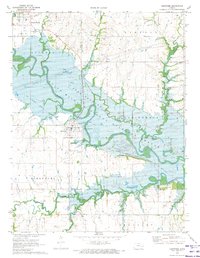
1970 Map of Hartford
USGS Topo · Published 1973About this map
Neosho River waters dominate this landscape as they flow into the expansive John Redmond Reservoir, a central feature of the Flint Hills National Wildlife Refuge. The map illustrates a transitional period for the area around Hartford and Neosho Rapids, where the natural river course meets the managed waters of the reservoir. A significant portion of the terrain is marked as a zone subject to controlled inundation, reflecting the hydrological engineering required for flood control and habitat management.
Find a feature on this map
31 named features on this map. Tap any name to fly to it.
Don’t see what you’re looking for? This feature index may not catch every label — zoom into the map to look around manually.
Map Details
Editions of this 1970 Hartford Map
This is the sole edition of this map. No revisions or reprints were ever made.
Other maps of this area

1885 · Burlington
USGS Topo · 1:125,000

1888 · Emporia
USGS Topo · 1:125,000

1894 · Emporia
USGS Topo · 1:125,000

1894 · Burlington
USGS Topo · 1:125,000

1947 · Lawrence
USGS Topo · 1:250,000

1950 · Lawrence
USGS Topo · 1:250,000

1955 · Hutchinson
USGS Topo · 1:250,000

1956 · Lawrence
USGS Topo · 1:250,000

1957 · Lang
USGS Topo · 1:24,000

1957 · Lebo
USGS Topo · 1:24,000