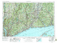
1962 Map of Hartford
USGS Topo · Published 1976About this map
Long Island Sound anchors this mid-century view of southern New England and the lower Hudson Valley, documenting a region defined by its historic river-and-rail corridors. The industrial and administrative backbone of Connecticut is visible through major centers like Hartford, New Haven, and Bridgeport, while the landscape to the west rises into the Catskill Mountains and the Berkshire Hills. Transport infrastructure is prominent, showing the transition from established rail lines like the New York New Haven & Hartford RR to the post-war expansion of the Interstate system, including Interstate 95 and the Merritt Parkway. Coastal geography is detailed from the Norwalk Islands to Montauk Point, highlighting the strategic placement of the Submarine Base near New London and the West Point Military Academy on the Hudson River.
Find a feature on this map
215 named features on this map. Tap any name to fly to it.
Don’t see what you’re looking for? This feature index may not catch every label — zoom into the map to look around manually.
Map Details
Editions of this 1962 Hartford Map
3 editions found

Other maps of this area

1885 · Sheffield
USGS Topo · 1:62,500

1886 · Springfield
USGS Topo · 1:62,500

1887 · Brookfield
USGS Topo · 1:62,500

1887 · Palmer
USGS Topo · 1:62,500

1887 · Granville
USGS Topo · 1:62,500

1888 · Sheffield
USGS Topo · 1:62,500

1888 · Sandisfield
USGS Topo · 1:62,500

1888 · Paterson
USGS Topo · 1:62,500

1889 · Springfield
USGS Topo · 1:62,500

1889 · Stonington
USGS Topo · 1:62,500