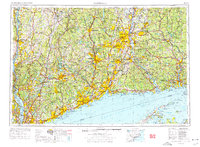
1962 Map of Hartford
USGS Topo · Published 1976About this map
The Connecticut River and Housatonic River valleys anchor this regional study of Southern New England and the lower Hudson Valley. Published in the mid-1970s from earlier data, the map illustrates the mature industrial corridor connecting Hartford and New Haven with the burgeoning suburbs of White Plains and Stamford. This era is defined by the massive infrastructure of the Merritt Parkway and the New York State Thruway, which facilitated the mid-century expansion of coastal cities like Bridgeport and Norwalk. Beyond the urban centers, the map documents significant land-use changes, such as the major water supply systems at Ashokan Reservoir and Quabbin Reservoir. The presence of the West Point Military Academy on the Hudson River and vast protected lands like Harriman State Park offer a clear view of the balance between dense development and preserved natural spaces.
Find a feature on this map
80 named features on this map. Tap any name to fly to it.
Don’t see what you’re looking for? This feature index may not catch every label — zoom into the map to look around manually.
Map Details
Editions of this 1962 Hartford Map
3 editions found

Other maps of this area

1885 · Sheffield
USGS Topo · 1:62,500

1886 · Springfield
USGS Topo · 1:62,500

1887 · Brookfield
USGS Topo · 1:62,500

1887 · Palmer
USGS Topo · 1:62,500

1887 · Granville
USGS Topo · 1:62,500

1888 · Sheffield
USGS Topo · 1:62,500

1888 · Sandisfield
USGS Topo · 1:62,500

1888 · Paterson
USGS Topo · 1:62,500

1889 · Springfield
USGS Topo · 1:62,500

1889 · Stonington
USGS Topo · 1:62,500