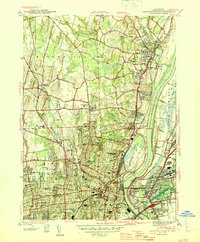
1945 Map of Hartford North
USGS Topo · Published 1945About this map
The Connecticut River serves as the central artery for this mid-century survey, dividing the densely developed streets of Hartford and East Hartford from the northern agricultural and suburban reaches of Bloomfield and Windsor. The landscape is a dense network of institutional and educational landmarks, featuring the sprawling Loomis Institute near the confluence of the Farmington River and the river-crossing Bulkeley Bridge. Urban development is concentrated south of Keney Park, where dozens of neighborhood schools like Weaver High Sch and Vine St Sch appear alongside major civic sites including the State Capitol and St Francis Hospital. The industrial and transit infrastructure is anchored by the New York New Haven and Hartford RR, which follows the riverbank, while numerous cemeteries such as Mt St Benedict Cemetery and Old North Cem mark the heritage of these long-established communities.
Find a feature on this map
114 named features on this map. Tap any name to fly to it.
Don’t see what you’re looking for? This feature index may not catch every label — zoom into the map to look around manually.
Map Details
Editions of this 1945 Hartford North Map
2 editions found

Other maps of this area

1892 · Hartford
USGS Topo · 1:62,500

1892 · Meriden
USGS Topo · 1:62,500

1892 · Granby
USGS Topo · 1:62,500

1893 · Middletown
USGS Topo · 1:62,500

1893 · Meriden
USGS Topo · 1:62,500

1906 · Farmington
USGS Topo · 1:125,000

1928 · Windsor Locks
USGS Topo · 1:24,000

1928 · Windsor
USGS Topo · 1:24,000

1928 · Glastonbury
USGS Topo · 1:24,000

1928 · Broad Brook
USGS Topo · 1:24,000