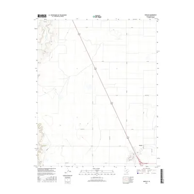
2016 Map of Hartley
USGS Topo · Published 2016About this map
The settlement of Hartley serves as the focal point for this 2016 survey of the Texas Panhandle. Located in the southeastern corner of the map, the town's grid is clearly defined by streets such as Main St, Dodge St, and Johnson St, which sit adjacent to the convergence of major regional highways. The surrounding landscape reflects the vast agricultural and ranching heritage of Hartley County, characterized by a geometric network of county roads including Thompson Rd and Bockner Rd. In the northwestern quadrant, the terrain shifts near the winding path of Rita Blanca Cr, where the topography breaks from the level high plains into more varied relief. This map provides an essential view of the modern infrastructure and rural layout that sustains this high plains community.
Find a feature on this map
23 named features on this map. Tap any name to fly to it.
Don’t see what you’re looking for? This feature index may not catch every label — zoom into the map to look around manually.
Map Details
Editions of this 2016 Hartley Map
This is the sole edition of this map. No revisions or reprints were ever made.
Other maps of this area

1954 · Tucumcari
USGS Topo · 1:250,000

1954 · Dalhart
USGS Topo · 1:250,000

1958 · Tucumcari
USGS Topo · 1:250,000

1958 · Dalhart
USGS Topo · 1:250,000

1962 · Dalhart
USGS Topo · 1:250,000

1963 · Hartley SE
USGS Topo · 1:24,000

1963 · Hartley NE
USGS Topo · 1:24,000

1965 · Wilco
USGS Topo · 1:24,000

1972 · Hartley SW
USGS Topo · 1:24,000

1973 · Pardue Camp
USGS Topo · 1:24,000