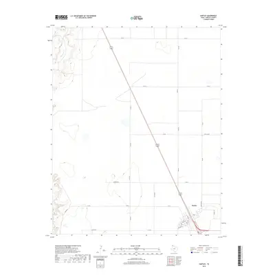
2019 Map of Hartley
USGS Topo · Published 2019About this map
Hartley serves as the primary focal point of this Panhandle landscape, where the town's street grid reflects a classic high plains settlement pattern at the junction of major regional transit corridors. The community is defined by a central network including Main St, Dodge St, and 4th St, nestled within the vast ranching and agricultural expanse of Hartley County. To the northwest, the terrain is cut by the winding course of Rita Blanca Cr, providing a stark topographic contrast to the surrounding level plateaus. The map details a systematic grid of county roads, such as Co Rd 36 and Co Rd E, which facilitate movement between the town and outlying areas. Smaller landmarks like Airport Ln and Thompson Rd suggest the modern infrastructure and localized naming conventions that define this rural Texas community during the late 2010s.
Find a feature on this map
24 named features on this map. Tap any name to fly to it.
Don’t see what you’re looking for? This feature index may not catch every label — zoom into the map to look around manually.
Map Details
Editions of this 2019 Hartley Map
This is the sole edition of this map. No revisions or reprints were ever made.
Other maps of this area

1954 · Tucumcari
USGS Topo · 1:250,000

1954 · Dalhart
USGS Topo · 1:250,000

1958 · Tucumcari
USGS Topo · 1:250,000

1958 · Dalhart
USGS Topo · 1:250,000

1962 · Dalhart
USGS Topo · 1:250,000

1963 · Hartley SE
USGS Topo · 1:24,000

1963 · Hartley NE
USGS Topo · 1:24,000

1965 · Wilco
USGS Topo · 1:24,000

1972 · Hartley SW
USGS Topo · 1:24,000

1973 · Pardue Camp
USGS Topo · 1:24,000