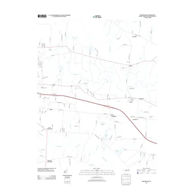
2013 Map of Hartsease
USGS Topo · Published 2013About this map
The Tar River meanders across this rural landscape in Edgecombe County, defining a territory of low-lying swamps and dispersed crossroads communities. The area is characterized by significant wetlands including Cokey Swamp, Buck Swamp, and Little Cokey Swamp, which historically dictated the pattern of settlement and agriculture. Smaller hamlets like Wrendale, Dunbar, and Penelo serve as local anchors along the road network, while the Rocky Mount Fairgrounds marks the western edge of the quadrangle. For genealogists and local historians, the map preserves specific localized place names such as Bullucks Crossroads and West Edgecombe, alongside family-named water features and landmarks like Nobles Millpond and Wiggins Lake. The presence of Bulluck School Rd hints at former rural education centers that once served these agrarian communities.
Find a feature on this map
124 named features on this map. Tap any name to fly to it.
Don’t see what you’re looking for? This feature index may not catch every label — zoom into the map to look around manually.
Map Details
Editions of this 2013 Hartsease Map
This is the sole edition of this map. No revisions or reprints were ever made.
Other maps of this area

1902 · Rocky Mount
USGS Topo · 1:62,500

1902 · Tarboro
USGS Topo · 1:62,500

1903 · Tarboro
USGS Topo · 1:62,500

1904 · Rocky Mount
USGS Topo · 1:62,500

1953 · Norfolk
USGS Topo · 1:250,000

1953 · Rocky Mount
USGS Topo · 1:250,000

1954 · Rocky Mount
USGS Topo · 1:250,000

1960 · Draughn
USGS Topo · 1:24,000

1961 · Whitakers
USGS Topo · 1:24,000

1963 · Drake
USGS Topo · 1:24,000