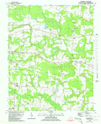
1981 Map of Hartsease
USGS Topo · Published 1981About this map
Tar River meanders through the heart of this coastal plain landscape, defining the agricultural and social geography of Edgecombe County. The river's winding course is flanked by extensive wetlands like Buck Swamp and Cokey Swamp, while the upland areas are dotted with small crossroads communities and rural institutions. The infrastructure of the early 1980s is visible in the alignment of the Seaboard Coast Line railroad, which links Kingsboro and Hartsboro, serving as a primary transportation artery through the region.
Find a feature on this map
49 named features on this map. Tap any name to fly to it.
Don’t see what you’re looking for? This feature index may not catch every label — zoom into the map to look around manually.
Map Details
Editions of this 1981 Hartsease Map
2 editions found
Other maps of this area

1902 · Rocky Mount
USGS Topo · 1:62,500

1902 · Tarboro
USGS Topo · 1:62,500

1903 · Tarboro
USGS Topo · 1:62,500

1904 · Rocky Mount
USGS Topo · 1:62,500

1953 · Norfolk
USGS Topo · 1:250,000

1953 · Rocky Mount
USGS Topo · 1:250,000

1954 · Rocky Mount
USGS Topo · 1:250,000

1960 · Draughn
USGS Topo · 1:24,000

1961 · Whitakers
USGS Topo · 1:24,000

1963 · Drake
USGS Topo · 1:24,000