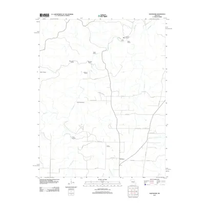
2012 Map of Hartshorn
USGS Topo · Published 2012About this map
Hartshorn serves as the primary settlement hub in this part of Texas County, situated where Casto Valley Creek and South Fork Black Valley Creek influence the local drainage. This high-resolution topographic study of the Salem Plateau reveals a landscape defined by an intricate network of hollows, reflecting the karst topography common to the region. Family names and local history are preserved through sites like the Smith Cemetery and Antioch Cemetery, while the northern portion of the quadrangle is anchored by the small community of Nile. The geography is characterized by the meandering path of Big Creek, which is fed by numerous named drainages such as Dry Bone Creek and Hay Creek. Significant landforms including Rebel Cave Hollow, Bee Rock Hollow, and Dew Pond Hollow illustrate the rugged, dissected nature of the plateau, providing a clear record of the area's rural road network and isolated valley settlements.
Find a feature on this map
39 named features on this map. Tap any name to fly to it.
Don’t see what you’re looking for? This feature index may not catch every label — zoom into the map to look around manually.
Map Details
Editions of this 2012 Hartshorn Map
This is the sole edition of this map. No revisions or reprints were ever made.
Other maps of this area

1932 · Cedar Grove
USGS Topo · 1:48,000

1945 · Clear Springs
USGS Topo · 1:62,500

1946 · Summersville
USGS Topo · 1:62,500

1948 · Clear Springs
USGS Topo · 1:62,500

1948 · Summersville
USGS Topo · 1:62,500

1949 · Rolla
USGS Topo · 1:250,000

1951 · Montauk
USGS Topo · 1:24,000

1951 · Licking
USGS Topo · 1:24,000

1951 · Cedargrove
USGS Topo · 1:24,000

1951 · Raymondville
USGS Topo · 1:24,000