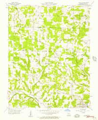
1956 Map of Hartville
USGS Topo · Published 1957About this map
Hartville serves as the focal point of this Wright County survey, situated at the confluence of Woods Fork and the Gasconade River. The mid-1950s landscape is characterized by a dense network of rural infrastructure, including a significant concentration of country schools such as Luallin Sch, Rogers Sch, and Little Creek Sch. These landmarks, along with the Kindrick Sch (Abandoned), reflect the changing educational footprint of the Missouri Ozarks during this period.
Find a feature on this map
43 named features on this map. Tap any name to fly to it.
Don’t see what you’re looking for? This feature index may not catch every label — zoom into the map to look around manually.
Map Details
Editions of this 1956 Hartville Map
2 editions found
Other maps of this area

1931 · Manes
USGS Topo · 1:48,000

1941 · Manes
USGS Topo · 1:62,500

1943 · Manes
USGS Topo · 1:62,500

1951 · Owens
USGS Topo · 1:24,000

1951 · Mansfield NE
USGS Topo · 1:24,000

1951 · Mansfield NW
USGS Topo · 1:24,000

1951 · Mountain Grove
USGS Topo · 1:62,500

1954 · Springfield
USGS Topo · 1:250,000

1956 · Duncan
USGS Topo · 1:24,000

1956 · Rader
USGS Topo · 1:24,000