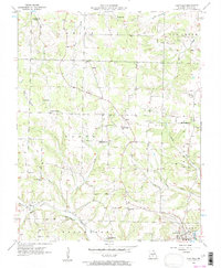
1956 Map of Hartville
USGS Topo · Published 1958About this map
Hartville serves as the focal point for this mid-century topographic study, situated where the Gasconade River and several tributary branches converge. The landscape is defined by the rural townships of Union, Boone, Elk Creek, and Brush Creek, which reveal a dense network of local landmarks essential for genealogical research. Numerous country schoolhouses, such as Rogers Sch, Luallin Sch, and the Kindrick Sch (Abandoned), are scattered across the terrain, reflecting the educational infrastructure of a decentralized farming community.
Find a feature on this map
35 named features on this map. Tap any name to fly to it.
Don’t see what you’re looking for? This feature index may not catch every label — zoom into the map to look around manually.
Map Details
Editions of this 1956 Hartville Map
2 editions found
Other maps of this area

1931 · Manes
USGS Topo · 1:48,000

1941 · Manes
USGS Topo · 1:62,500

1943 · Manes
USGS Topo · 1:62,500

1951 · Owens
USGS Topo · 1:24,000

1951 · Mansfield NE
USGS Topo · 1:24,000

1951 · Mansfield NW
USGS Topo · 1:24,000

1951 · Mountain Grove
USGS Topo · 1:62,500

1954 · Springfield
USGS Topo · 1:250,000

1956 · Duncan
USGS Topo · 1:24,000

1956 · Rader
USGS Topo · 1:24,000