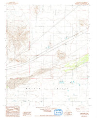
1982 Map of Harvard Hill
USGS Topo · Published 1993About this map
Mojave Valley and the dry expanse of the Mojave Desert dominate this landscape, which was meticulously field-checked in 1976 and updated with 1991 aerial imagery. The map reveals an unusual cluster of artificial oases in this arid environment, including the recreational waters of Lake Dolores and Lake Tami. The settlement of Harvard sits as a primary waypoint along the corridor of infrastructure that cuts through the valley floor. Large-scale utility projects are prominent, defined by multiple corridors including the Steel Tower Transmission Line and Steel Pole Transmission Line that traverse the open terrain near Harvard Hill. Along the seasonal path of the Mojave River, small-scale aviation markers like a Dirt Air Strip and Dirt Airstrip Facilities suggest the area's role as a remote hub for private transport and desert recreation during the late twentieth century.
Find a feature on this map
14 named features on this map. Tap any name to fly to it.
Don’t see what you’re looking for? This feature index may not catch every label — zoom into the map to look around manually.
Map Details
Editions of this 1982 Harvard Hill Map
2 editions found
Other maps of this area

1933 · Avawatz Mountains
USGS Topo · 1:250,000

1947 · Trona
USGS Topo · 1:250,000

1948 · Trona
USGS Topo · 1:250,000

1948 · Alvord Mountain
USGS Topo · 1:62,500

1948 · Lane Mountain
USGS Topo · 1:62,500

1951 · Alvord Mountain
USGS Topo · 1:62,500

1951 · Lane Mountain
USGS Topo · 1:62,500

1953 · San Bernardino
USGS Topo · 1:250,000

1953 · Yermo
USGS Topo · 1:24,000

1953 · Trona
USGS Topo · 1:250,000