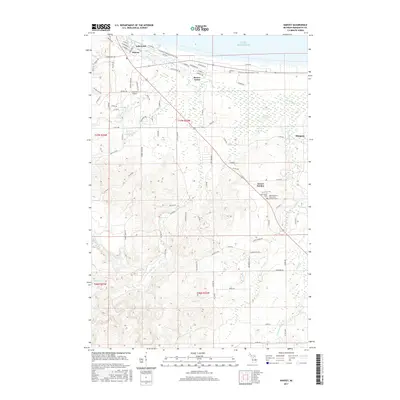
2017 Map of Harvey
USGS Topo · Published 2017About this map
The Chocolay River snakes northward toward the southern shore of Lake Superior in this recent survey of Marquette County. The landscape is defined by its transition from the developed lakeshore communities of Harvey and Lakewood to the quieter, stream-cut uplands of the interior. In the crossroads settlement of Green Garden, the Green Garden / Saint Paul's Lutheran Cem and Saint Pauls Cem serve as focal points for local heritage and genealogy. The topography is intricately detailed, showing the varied drainage basins of Silver Creek, Cherry Creek, and Foster Creek. Aviation interests are represented by the Southfork Airport located near Beaver Grove. A significant stretch of the North Country National Scenic Trail winds through the northern portion of the quadrangle, illustrating the area's contemporary role in regional recreation and conservation.
Find a feature on this map
100 named features on this map. Tap any name to fly to it.
Don’t see what you’re looking for? This feature index may not catch every label — zoom into the map to look around manually.
Map Details
Editions of this 2017 Harvey Map
This is the sole edition of this map. No revisions or reprints were ever made.
Other maps of this area

1907 · Marquette
USGS Topo · 1:62,500

1932 · Skandia SW
USGS Topo · 1:31,680

1932 · Harvey NW
USGS Topo · 1:31,680

1932 · Harvey SE
USGS Topo · 1:31,680

1932 · Harvey SW
USGS Topo · 1:31,680

1932 · Harvey NE
USGS Topo · 1:31,680

1950 · Skandia NW
USGS Topo · 1:31,680

1952 · Sands
USGS Topo · 1:24,000

1952 · Gwinn
USGS Topo · 1:62,500

1952 · Gwinn
USGS Topo · 1:24,000