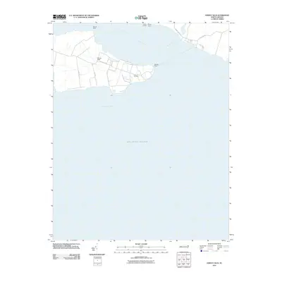
2010 Map of Harvey Neck
USGS Topo · Published 2010About this map
Harvey Neck extends into the broad waters of the Albemarle Sound, defined by its intricate shoreline and the convergence of the Perquimans River and Muddy Creek. This coastal landscape at the start of the 21st century shows a distinct pattern of road networks like Harvey Point Rd and Cross Neck Rd that navigate the low-lying peninsula. Local history is anchored by the Harvey Cemetery, situated centrally on the neck near Harvey Point. The map details the transition from the river mouth at Blount Point and Newby Landing to the open expanse designated as the Atlantic Ocean in the sound's southeastern reaches. The arrangement of residential parcels and local routes such as Goose Nest Ln reflects the enduring coastal character of this North Carolina peninsula.
Find a feature on this map
16 named features on this map. Tap any name to fly to it.
Don’t see what you’re looking for? This feature index may not catch every label — zoom into the map to look around manually.
Map Details
Editions of this 2010 Harvey Neck Map
This is the sole edition of this map. No revisions or reprints were ever made.
Other maps of this area

1906 · Hertford
USGS Topo · 1:62,500

1940 · Hertford
USGS Topo · 1:62,500

1940 · Wade Point
USGS Topo · 1:62,500

1943 · Wade Point
USGS Topo · 1:62,500

1943 · Columbia
USGS Topo · 1:125,000

1948 · Wade Point
USGS Topo · 1:62,500

1953 · Norfolk
USGS Topo · 1:250,000

1953 · Columbia East
USGS Topo · 1:24,000

1953 · Columbia West
USGS Topo · 1:24,000

1953 · Rocky Mount
USGS Topo · 1:250,000