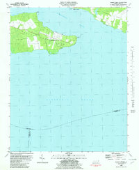
1982 Map of Harvey
USGS Topo · Published 1982About this map
Harvey Point Defense Testing Activity dominates the peninsula between the Perquimans River and Albemarle Sound, a landscape shaped by coastal defense and maritime access. This early 1980s survey illustrates the specialized military use of Harvey Neck, featuring a Landing Strip and seawalls along the shoreline. In addition to the testing facility, the map preserves older family and local landmarks, such as Harvey Cem and the small settlement at Newby Landing near Piney Point. The eastern portion of the sheet covers Durants Neck, separated by the mouth of Muddy Creek. The presence of multiple points and bays, including Blount Point and Halsey Bay, emphasizes the area's historical reliance on the sound and river for transportation and local commerce before the era of modern highway development.
Find a feature on this map
16 named features on this map. Tap any name to fly to it.
Don’t see what you’re looking for? This feature index may not catch every label — zoom into the map to look around manually.
Map Details
Editions of this 1982 Harvey Map
This is the sole edition of this map. No revisions or reprints were ever made.
Other maps of this area

1906 · Hertford
USGS Topo · 1:62,500

1940 · Hertford
USGS Topo · 1:62,500

1940 · Wade Point
USGS Topo · 1:62,500

1943 · Wade Point
USGS Topo · 1:62,500

1943 · Columbia
USGS Topo · 1:125,000

1948 · Wade Point
USGS Topo · 1:62,500

1953 · Norfolk
USGS Topo · 1:250,000

1953 · Columbia East
USGS Topo · 1:24,000

1953 · Columbia West
USGS Topo · 1:24,000

1953 · Rocky Mount
USGS Topo · 1:250,000