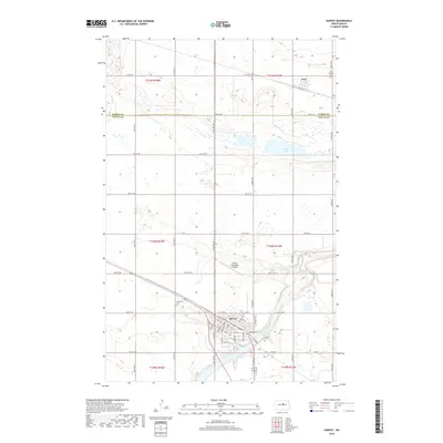
2018 Map of Harvey
USGS Topo · Published 2018About this map
Harvey serves as the regional hub of this Wells County landscape, situated at a bend in the Sheyenne River. The town's grid is dense with named streets like Brewster St and Advent St, reflecting a well-established prairie community. Further north, the smaller settlement of Selz sits near the border of Pierce Co and Wells Co, marked by the presence of Saint Anthony Cem. The surrounding terrain is defined by a glacial prairie pothole topography, with numerous small wetlands and larger bodies like Goose Lake scattered across the township lines.
Find a feature on this map
48 named features on this map. Tap any name to fly to it.
Don’t see what you’re looking for? This feature index may not catch every label — zoom into the map to look around manually.
Map Details
Editions of this 2018 Harvey Map
This is the sole edition of this map. No revisions or reprints were ever made.
Other maps of this area

1940 · Aylmer
USGS Topo · 1:62,500

1941 · Selz
USGS Topo · 1:62,500

1945 · Manfred
USGS Topo · 1:62,500

1946 · Sheyenne Lake
USGS Topo · 1:48,000

1947 · Sheyenne Lake
USGS Topo · 1:62,500

1948 · Manfred
USGS Topo · 1:62,500

1950 · Wellsburg
USGS Topo · 1:24,000

1950 · Manfred NW
USGS Topo · 1:24,000

1950 · Sheyenne Lake NE
USGS Topo · 1:24,000

1950 · Manfred
USGS Topo · 1:24,000