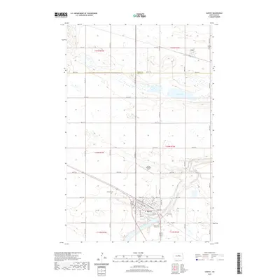
2020 Map of Harvey
USGS Topo · Published 2020About this map
The Sheyenne River winds across the southern reaches of this landscape, anchoring the regional hub of Harvey in Wells County. This modern survey illustrates the town's established grid, where residential streets meet local landmarks like Judy Blvd and Brewster St. A significant concentration of local heritage sites is visible here, including Sunnyside Cem and Saint Cecilia Catholic Cem, providing a detailed record for genealogists and researchers tracking family histories in the central North Dakota prairie.
Find a feature on this map
38 named features on this map. Tap any name to fly to it.
Don’t see what you’re looking for? This feature index may not catch every label — zoom into the map to look around manually.
Map Details
Editions of this 2020 Harvey Map
This is the sole edition of this map. No revisions or reprints were ever made.
Other maps of this area

1940 · Aylmer
USGS Topo · 1:62,500

1941 · Selz
USGS Topo · 1:62,500

1945 · Manfred
USGS Topo · 1:62,500

1946 · Sheyenne Lake
USGS Topo · 1:48,000

1947 · Sheyenne Lake
USGS Topo · 1:62,500

1948 · Manfred
USGS Topo · 1:62,500

1950 · Wellsburg
USGS Topo · 1:24,000

1950 · Manfred NW
USGS Topo · 1:24,000

1950 · Sheyenne Lake NE
USGS Topo · 1:24,000

1950 · Manfred
USGS Topo · 1:24,000