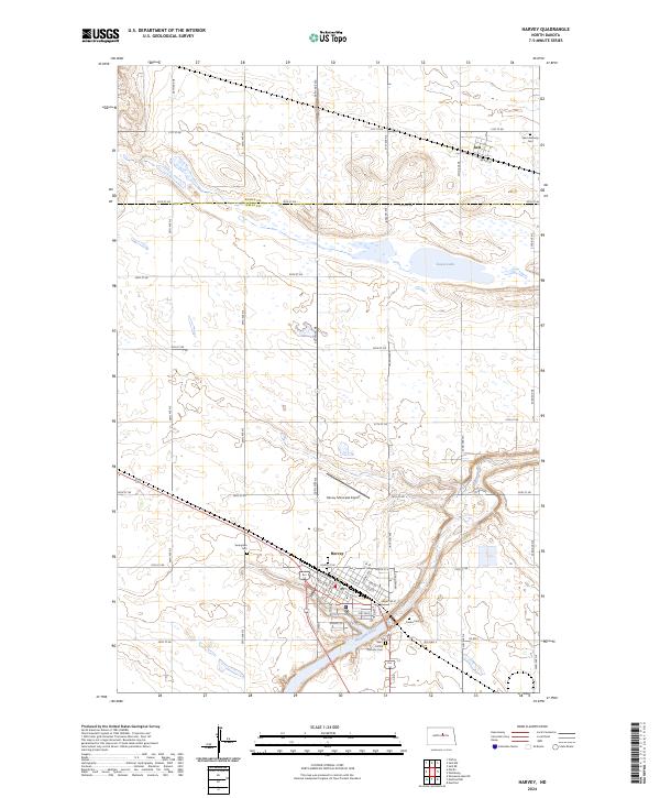
2024 Map of Harvey
USGS Topo · Published 2024About this map
Harvey serves as the primary hub in this central North Dakota landscape, situated at the intersection of a developed street grid and the winding Sheyenne River. The town's layout is defined by residential thoroughfares like Alder Ave and Elm Ave, as well as several local cemeteries that anchor the community's history, including Cooke Cem and Saint Cecilia Catholic Cem. The surrounding plains are characterized by numerous small prairie potholes and wetlands typical of the region, with Goose Lake standing out as a significant water body to the northeast.
Find a feature on this map
51 named features on this map. Tap any name to fly to it.
Don’t see what you’re looking for? This feature index may not catch every label — zoom into the map to look around manually.
Map Details
Editions of this 2024 Harvey Map
This is the sole edition of this map. No revisions or reprints were ever made.
Other maps of this area

1940 · Aylmer
USGS Topo · 1:62,500

1941 · Selz
USGS Topo · 1:62,500

1945 · Manfred
USGS Topo · 1:62,500

1946 · Sheyenne Lake
USGS Topo · 1:48,000

1947 · Sheyenne Lake
USGS Topo · 1:62,500

1948 · Manfred
USGS Topo · 1:62,500

1950 · Wellsburg
USGS Topo · 1:24,000

1950 · Manfred NW
USGS Topo · 1:24,000

1950 · Sheyenne Lake NE
USGS Topo · 1:24,000

1950 · Manfred
USGS Topo · 1:24,000