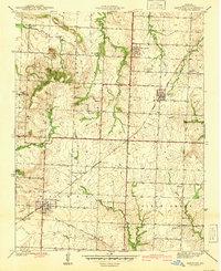
1941 Map of Harwood
USGS Topo · Published 1941About this map
Walker and Harwood anchor this 1939 survey of Vernon County, Missouri, where the tracks of the Missouri Kansas Texas railroad dictate the local economic rhythm. The landscape is dotted with rural centers of civic life, including numerous schoolhouses such as Blue Mound Sch and Robinson Sch, alongside community spaces like Mt Vernon Ch. The terrain transitions from the prominence of Blue Mound and Pepper Hill to the well-watered lowlands of Kitten Creek and Metton Creek. This map captures a quintessential Midwestern rural layout before modern consolidation, where small settlements like Fair Haven and Handley served as local hubs. Genealogists will find particular value in the placement of several burial grounds, including Harwood Cem and Bethany Cem, which provide a geographic anchor for early families in the Walker and Clear Creek townships.
Find a feature on this map
28 named features on this map. Tap any name to fly to it.
Don’t see what you’re looking for? This feature index may not catch every label — zoom into the map to look around manually.
Map Details
Editions of this 1941 Harwood Map
2 editions found
Other maps of this area

1886 · Nevada
USGS Topo · 1:125,000

1887 · Butler
USGS Topo · 1:125,000

1894 · Butler
USGS Topo · 1:125,000

1894 · Nevada
USGS Topo · 1:125,000

1933 · Camp Clark
USGS Topo · 1:24,000

1934 · Papinsville
USGS Topo · 1:24,000

1934 · Rockville
USGS Topo · 1:24,000

1936 · Rich Hill
USGS Topo · 1:24,000

1938 · Horton
USGS Topo · 1:24,000

1939 · Horton
USGS Topo · 1:24,000