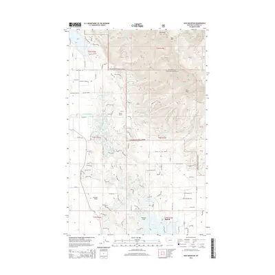
2014 Map of Hash Mountain
USGS Topo · Published 2014About this map
The Flathead Valley provides a sharp contrast between the dense residential and agricultural development on the valley floor and the ascent into the Flathead National Forest. This landscape is defined by its complex hydrology, featuring dozens of named water bodies like Lake Blaine, John Lake, and Swimming Lake. The lower elevations show a dense network of local roads such as Bachelor Grade and Mennonite Church Rd, reflecting a settled rural community. Moving east, the terrain rises into the Swan Range, anchored by the peak of Hash Mtn and the long spine of Peters Ridge. Historical land use is evident in features like Jessup Mill Pond and the Creston Cem, while the southern edge of the sheet includes the community of Bigfork near the shores of Echo Lake and its Firemens Island.
Find a feature on this map
112 named features on this map. Tap any name to fly to it.
Don’t see what you’re looking for? This feature index may not catch every label — zoom into the map to look around manually.
Map Details
Editions of this 2014 Hash Mountain Map
This is the sole edition of this map. No revisions or reprints were ever made.
Other maps of this area

1914 · Nyack
USGS Topo · 1:125,000

1943 · Kalispell
USGS Topo · 1:125,000

1957 · Kalispell
USGS Topo · 1:250,000

1960 · Kalispell
USGS Topo · 1:250,000

1960 · Cut Bank
USGS Topo · 1:250,000

1961 · Kalispell
USGS Topo · 1:250,000

1962 · Columbia Falls South
USGS Topo · 1:24,000

1962 · Doris Mountain
USGS Topo · 1:24,000

1962 · Somers
USGS Topo · 1:24,000

1962 · Creston
USGS Topo · 1:24,000