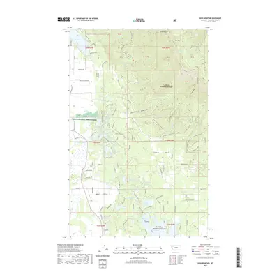
2020 Map of Hash Mountain
USGS Topo · Published 2020About this map
Lake Blaine and the western slopes of the Swan Range define this portion of Flathead County, where the valley floor meets the high timber of the Flathead National Forest. The transition from agricultural land to montane wilderness is marked by the Creston National Fish Hatchery and the small community of Creston. Local history is anchored by the Creston Cem and the former industrial site at Jessup Mill Pond, reflecting the area's early 20th-century reliance on timber and water resources. Higher elevations toward Hash Mtn and Peters Ridge are dotted with numerous small alpine bodies of water including Lamoose Lake and Grayling Lake Number Two. The dense network of forest roads and trails, such as Madera Trl and Lake Blaine Rd, illustrates the modern landscape's focus on conservation and recreation within the national forest boundaries.
Find a feature on this map
104 named features on this map. Tap any name to fly to it.
Don’t see what you’re looking for? This feature index may not catch every label — zoom into the map to look around manually.
Map Details
Editions of this 2020 Hash Mountain Map
This is the sole edition of this map. No revisions or reprints were ever made.
Other maps of this area

1914 · Nyack
USGS Topo · 1:125,000

1943 · Kalispell
USGS Topo · 1:125,000

1957 · Kalispell
USGS Topo · 1:250,000

1960 · Kalispell
USGS Topo · 1:250,000

1960 · Cut Bank
USGS Topo · 1:250,000

1961 · Kalispell
USGS Topo · 1:250,000

1962 · Columbia Falls South
USGS Topo · 1:24,000

1962 · Doris Mountain
USGS Topo · 1:24,000

1962 · Somers
USGS Topo · 1:24,000

1962 · Creston
USGS Topo · 1:24,000