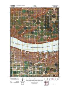
2011 Map of Hat Rock
USGS Topo · Published 2011About this map
The Columbia River dominates this portion of the Pacific Northwest, serving as the boundary between Washington and Oregon. On the southern shore, Hat Rock State Park anchors the riverfront, highlighting the distinctive geology of Hat Rock and Boat Rock. The landscape transitioning away from the water is defined by an agricultural and transportation network, centered around Cold Springs Junction and the operations at the Beef City Feedlot.
Find a feature on this map
42 named features on this map. Tap any name to fly to it.
Don’t see what you’re looking for? This feature index may not catch every label — zoom into the map to look around manually.
Map Details
Editions of this 2011 Hat Rock Map
This is the sole edition of this map. No revisions or reprints were ever made.
Other maps of this area

1908 · Umatilla
USGS Topo · 1:125,000

1917 · Pasco
USGS Topo · 1:125,000

1953 · Pendleton
USGS Topo · 1:250,000

1953 · Walla Walla
USGS Topo · 1:250,000

1956 · Pendleton
USGS Topo · 1:250,000

1958 · Walla Walla
USGS Topo · 1:250,000

1962 · Hat Rock
USGS Topo · 1:24,000

1962 · Stanfield
USGS Topo · 1:24,000

1962 · Hermiston
USGS Topo · 1:24,000

1962 · Juniper
USGS Topo · 1:24,000