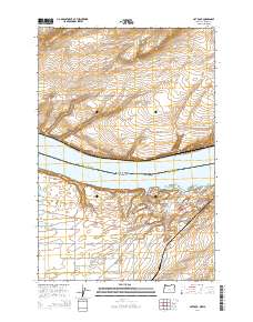
2014 Map of Hat Rock
USGS Topo · Published 2014About this map
The Columbia River defines the border between Washington and Oregon in this 2014 survey, where the waters of Lake Wallula fill the valley floor. On the Oregon shore, the landscape is marked by the distinctive Hat Rock and the nearby Boat Rock, landmarks that have guided river travelers for generations. Further inland, the settlement of Cold Springs Junction serves as a modern crossroads where Us-730 meets Or-37, connecting the riverfront to the agricultural uplands.
Find a feature on this map
36 named features on this map. Tap any name to fly to it.
Don’t see what you’re looking for? This feature index may not catch every label — zoom into the map to look around manually.
Map Details
Editions of this 2014 Hat Rock Map
This is the sole edition of this map. No revisions or reprints were ever made.
Other maps of this area

1908 · Umatilla
USGS Topo · 1:125,000

1917 · Pasco
USGS Topo · 1:125,000

1953 · Pendleton
USGS Topo · 1:250,000

1953 · Walla Walla
USGS Topo · 1:250,000

1956 · Pendleton
USGS Topo · 1:250,000

1958 · Walla Walla
USGS Topo · 1:250,000

1962 · Hat Rock
USGS Topo · 1:24,000

1962 · Stanfield
USGS Topo · 1:24,000

1962 · Hermiston
USGS Topo · 1:24,000

1962 · Juniper
USGS Topo · 1:24,000