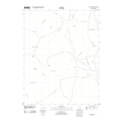
2011 Map of Hatch Rock
USGS Topo · Published 2011About this map
Hatch Point dominates this high desert landscape, serving as a hub for a network of remote roads including Needles Overlook Rd and the historic Mail Station Rd. The terrain is defined by dramatic geological formations and deep canyons such as Hatch Ranch Canyon and Bobbys Hole Canyon. Water management is critical in this arid environment, evidenced by Little Rock Reservoir and The Tank, which provide essential catchments in an area carved by intermittent drainages like Hatch Wash and Mail Station Wash. Prominent monoliths and mesas, including Hatch Rock, Jail Rock, and Rone Bailey Mesa, provide distinct landmarks for navigation across Dry Valley. The presence of Wind Whistle Campground near Wind Whistle Rock highlights the area's modern role for recreation and public land access within the high plateau system.
Find a feature on this map
30 named features on this map. Tap any name to fly to it.
Don’t see what you’re looking for? This feature index may not catch every label — zoom into the map to look around manually.
Map Details
Editions of this 2011 Hatch Rock Map
This is the sole edition of this map. No revisions or reprints were ever made.
Other maps of this area

1885 · La Sal
USGS Topo · 1:250,000

1954 · Mt Peale 3 NW
USGS Topo · 1:24,000

1954 · Mt Peale 3 SW
USGS Topo · 1:24,000

1954 · Mt Peale 3 NE
USGS Topo · 1:24,000

1954 · Mt Peale 3 SE
USGS Topo · 1:24,000

1954 · Mt Peale 2 SW
USGS Topo · 1:24,000

1954 · Mt Peale 2 SE
USGS Topo · 1:24,000
1954 · Carlisle 4 SE
USGS Topo · 1:24,000

1954 · Carlisle 1 SE
USGS Topo · 1:24,000

1954 · Carlisle 4 NE
USGS Topo · 1:24,000