
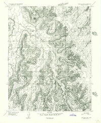
1954 Map of Mt Peale 3 NW
USGS Topo · Published 1955About this map
Hatch Point dominates the high ground of this San Juan County landscape, providing a stark topographical divide between the upper plateaus and the intricate drainage networks below. In the mid-1950s, this area of Utah remained largely defined by its natural landforms and early water management efforts, such as the CCC Reservoir. Named landmarks like Wind Whistle Rock, Jail Rock, and Soup Rock suggest a geography well-known to local ranchers and early travelers who navigated the deep incisions of Hatch Wash.
Find a feature on this map
26 named features on this map. Tap any name to fly to it.
Don’t see what you’re looking for? This feature index may not catch every label — zoom into the map to look around manually.
Map Details
Editions of this 1954 Mt Peale 3 NW Map
This is the sole edition of this map. No revisions or reprints were ever made.
Other maps of this area

1885 · La Sal
USGS Topo · 1:250,000

1954 · Mt Peale 3 SW
USGS Topo · 1:24,000

1954 · Mt Peale 3 NE
USGS Topo · 1:24,000

1954 · Mt Peale 3 SE
USGS Topo · 1:24,000

1954 · Mt Peale 2 SW
USGS Topo · 1:24,000

1954 · Mt Peale 2 SE
USGS Topo · 1:24,000
1954 · Carlisle 4 SE
USGS Topo · 1:24,000

1954 · Carlisle 1 SE
USGS Topo · 1:24,000

1954 · Carlisle 4 NE
USGS Topo · 1:24,000

1954 · La Sal Junction
USGS Topo · 1:62,500