
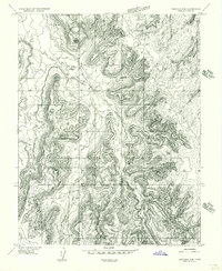
1954 Map of Carlisle 4 NE
USGS Topo · Published 1956About this map
Indian Creek and Three Mile Creek define the drainage patterns of this high desert terrain in San Juan County. This 1954 survey by the U.S. Geological Survey was produced as a preliminary edition, capturing the remote landscape before the completion of full 15-minute mapping for the region. The map reveals a sparse infrastructure focused on water management and resource exploration, characterized by the presence of a Spring and Res, a isolated Stock Tank, and a solitary Prospect. These features reflect a mid-century period when cattle ranching and mineral exploration were the primary human imprints on the land. The intricate contour work illustrates the complex erosion of the Draw systems, offering an essential look at the physical geography of southeastern Utah during the post-war era.
Find a feature on this map
10 named features on this map. Tap any name to fly to it.
Don’t see what you’re looking for? This feature index may not catch every label — zoom into the map to look around manually.
Map Details
Editions of this 1954 Carlisle 4 NE Map
This is the sole edition of this map. No revisions or reprints were ever made.
Other maps of this area

1885 · La Sal
USGS Topo · 1:250,000

1954 · Carlisle 4 SW
USGS Topo · 1:24,000

1954 · Mt Peale 3 NW
USGS Topo · 1:24,000

1954 · Mt Peale 3 SW
USGS Topo · 1:24,000

1954 · Mt Peale 2 SW
USGS Topo · 1:24,000

1954 · Carlisle 4 NW
USGS Topo · 1:24,000
1954 · Carlisle 4 SE
USGS Topo · 1:24,000

1954 · Carlisle 1 SE
USGS Topo · 1:24,000

1954 · Carlisle 1 SW
USGS Topo · 1:24,000

1954 · La Sal Junction
USGS Topo · 1:62,500