
1954 Map of Carlisle 4 NW
USGS Topo · Published 1956About this map
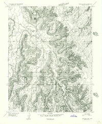
North Sixshooter Peak dominates the southern reaches of this mid-century topographic survey, serving as a primary landmark in a landscape defined by deep drainage networks and high mesas. The mapping captures the complex hydrology of the San Juan region, where Indian Creek and Hart Draw carve through the high plateaus. In the southwestern corner, Salt Creek meanders through the breaks, illustrating the isolation of this corner of Utah before extensive modern road development. This preliminary edition, based on 1953 aerial photography, provides a detailed record of the unimproved roads and township lines that provided the only framework for navigation in the canyon country during the 1950s.
Find a feature on this map
8 named features on this map. Tap any name to fly to it.
Don’t see what you’re looking for? This feature index may not catch every label — zoom into the map to look around manually.
Map Details
Editions of this 1954 Carlisle 4 NW Map
This is the sole edition of this map. No revisions or reprints were ever made.
Other maps of this area

1885 · La Sal
USGS Topo · 1:250,000

1951 · Upheaval Dome
USGS Topo · 1:62,500

1952 · Carlisle 2 SE
USGS Topo · 1:24,000

1953 · The Needles
USGS Topo · 1:62,500

1954 · Carlisle 4 SW
USGS Topo · 1:24,000
1954 · Carlisle 4 SE
USGS Topo · 1:24,000

1954 · Carlisle 1 SE
USGS Topo · 1:24,000

1954 · Carlisle 4 NE
USGS Topo · 1:24,000

1954 · Carlisle 1 SW
USGS Topo · 1:24,000
1954 · Harts Point
USGS Topo · 1:62,500