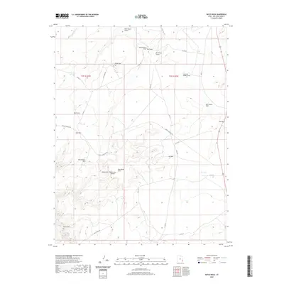
2020 Map of Hatch Rock
USGS Topo · Published 2020About this map
Hatch Rock serves as the namesake for this high desert landscape in San Juan County, where complex geological formations dictate the routes of modern roads and old trails. The terrain is defined by prominent landmarks like Rone Bailey Mesa and the striking Jail Rock, which stand above a network of deep drainages including Wind Whistle Draw and Bobbys Hole Canyon. Historical transport routes are central to the map, with the Mail Station Spu and Mall Station Wash suggesting the region's legacy of frontier communication and travel. The area's limited water sources are carefully marked, such as the Little Rock Reservoir and the seasonal Little Water Cr. Modern access is provided via Needles Overlook Rd and Highway 191, which skirt the edges of deep gulches like Hook and Ladder Gulch.
Find a feature on this map
31 named features on this map. Tap any name to fly to it.
Don’t see what you’re looking for? This feature index may not catch every label — zoom into the map to look around manually.
Map Details
Editions of this 2020 Hatch Rock Map
This is the sole edition of this map. No revisions or reprints were ever made.
Other maps of this area

1885 · La Sal
USGS Topo · 1:250,000

1954 · Mt Peale 3 NW
USGS Topo · 1:24,000

1954 · Mt Peale 3 SW
USGS Topo · 1:24,000

1954 · Mt Peale 3 NE
USGS Topo · 1:24,000

1954 · Mt Peale 3 SE
USGS Topo · 1:24,000

1954 · Mt Peale 2 SW
USGS Topo · 1:24,000

1954 · Mt Peale 2 SE
USGS Topo · 1:24,000
1954 · Carlisle 4 SE
USGS Topo · 1:24,000

1954 · Carlisle 1 SE
USGS Topo · 1:24,000

1954 · Carlisle 4 NE
USGS Topo · 1:24,000