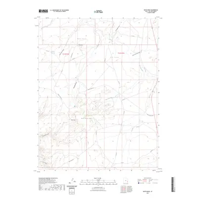
2023 Map of Hatch Rock
USGS Topo · Published 2023About this map
Rone Bailey Mesa dominates the central landscape of this San Juan County region, where the high desert is carved by complex drainages like Bobbys Hole Canyon and Wind Whistle Draw. The geography reflects the necessities of ranching and transit in a semi-arid environment, anchored by features like the Little Rock Reservoir and the descriptively named The Tank. Hatch Point and its namesake Hatch Rock stand as prominent landmarks above Dry Valley, providing clear orientation points for those navigating the plateau. To the south, Harts Draw cuts through the terrain, while historical travel routes are preserved in names like Mail Station Wash and the Mail Station Spu. The network of county roads, including Needles Overlook Rd, connects these remote canyons and mesa tops, illustrating the modern access to this long-utilized cattle and transit corridor.
Find a feature on this map
30 named features on this map. Tap any name to fly to it.
Don’t see what you’re looking for? This feature index may not catch every label — zoom into the map to look around manually.
Map Details
Editions of this 2023 Hatch Rock Map
This is the sole edition of this map. No revisions or reprints were ever made.
Other maps of this area

1885 · La Sal
USGS Topo · 1:250,000

1954 · Mt Peale 3 NW
USGS Topo · 1:24,000

1954 · Mt Peale 3 SW
USGS Topo · 1:24,000

1954 · Mt Peale 3 NE
USGS Topo · 1:24,000

1954 · Mt Peale 3 SE
USGS Topo · 1:24,000

1954 · Mt Peale 2 SW
USGS Topo · 1:24,000

1954 · Mt Peale 2 SE
USGS Topo · 1:24,000
1954 · Carlisle 4 SE
USGS Topo · 1:24,000

1954 · Carlisle 1 SE
USGS Topo · 1:24,000

1954 · Carlisle 4 NE
USGS Topo · 1:24,000